Maps and Views
Whitchurch is on the north bank of the Thames, about five miles west
of Reading. The postcode for The Greyhound, in the centre of the
village, is RG8 7EL.
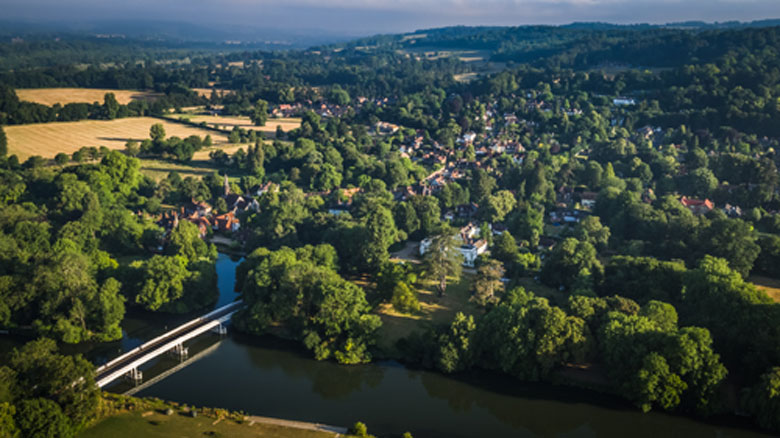
(Aerial photo reproduced by permission of Dave Olinski, taken 29th June 2018.)
Detailed map of the parish of Whitchurch, showing the Conservation Area
This SODC website shows house names and numbers plus planning applications - once the map has loaded, go to Whitchurch and zoom in by double-clicking repeatedly
Whitchurch from the air, a short film of Whitchurch and Pangbourne taken in February 2015
Painted map, illustrator Candida Kennedy’s creative aerial view shows Whitchurch among its neighbours. Copyright, but obtainable here
Hardwick Estate map, shows permissive paths as well as public rights of way
Aerial photograph of Whitchurch in wartime taken by the US Air Force in March 1944. North is at the left. Zoom in to see details such as the Manor Road camp and Bailey bridge training on Pangbourne Meadow.
Historic Maps
Historic map of 1897, in the Victoria County History of Oxfordshire, Volume XX, published in 2020
Historic Map of 1877, Whitchurch Parish entitled "1877 Survey" (added May 2025)
Historic Map of 1800, part of a land enclosure map from the Oxfordshire History Centre
Historic map of 1761 by John Rocque – with comments on interesting features
Side-by-side historic map comparison website